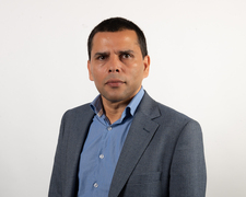
Pozivaju se zainteresirani studenti i nastavnici na predavanje koje će održati prof. Jagannath Aryal sa Faculty of Engineering and Information Technology, Melbourne na temu: „Earth observation images and intelligent methods in developing building footprint inventories: a sustainable city planning lens“.
Predavanje će se održati 16. srpnja 2024. u Velikoj vijećnici A219 od 10:00 do 11:00 sati.
Predavač: Dr Jagannath Aryal
Associate Professor, Digital Infrastructure Engineering
Department of Infrastructure Engineering | Faculty of Engineering and Information Technology
Melbourne Connect 6310
The University of Melbourne, Victoria 3010 Australia
web: https://findanexpert.unimelb.edu.au/profile/865150-jagannath-aryal
Program Director: Master of Digital Infrastructure Engineering
National Chair: Geospatial Council of Australia: GIS, Digital Analytics and Remote Sensing

Sažetak predavanja:
Sustainable city planning and optimal land use design are becoming challenges considering environmental sustainability, urban growth, and citizen science. Earth observation images contribute significantly in preparing accurate inventories of buildings and their varieties in addressing such challenges. However, despite the efforts in designing and managing urban buildings from Earth Observation images, there is a clear gap in knowledge in developing the spatial ecosystem of existing urban building management. This presentation draws a perspective by developing analytics on representative urban building footprint datasets with a focus on data quality issues. Issues such as the off-nadir imagery, omission/commission errors, and positional accuracy are considered in the analytics. These building footprint datasets are generated by the community for the public good and by the industry sectors for commercial benefits. The analytics supported in drawing perspective and the proposed spatial ecosystem ultimately help in developing an operational framework for urban infrastructure in sustainable city planning using Earth observation images and intelligent approaches.

 Instagram
 LinkedIn
 YouTube
 Facebook
 Prijava na servise